
Warminster Township ZIP Code Coverage
The research verifies one central postal identity for Warminster Township: 18974. It does not verify a full current list of every code that may touch the Township's edges, nor does it establish a public USPS polygon that matches the municipal boundary. The table therefore distinguishes a confirmed USPS record from an unverified-edge question. That is more useful than copying a generic list because a postal label is a delivery-routing tool, while the County parcel and municipality records govern the local geographic answer.
| ZIP | Areas covered | Post office | Notes |
|---|---|---|---|
| 18974 | Verified central Warminster postal identity; Township-wide edge coverage was not mapped in the research. | Warminster Post Office, 1135 Mearns Road | USPS location record identifies WARMINSTER, PA 18974-9998. This is postal evidence, not municipal-boundary proof. |
| Other possible ZIPs | Unverified for Township-serving coverage | No post office or coverage is asserted | Test a representative delivery address with USPS, then check the parcel municipality in Bucks GIS before naming another ZIP. |
There is no verified basis here to call a neighboring code a Warminster Township code, to describe a local post-office box code, or to identify a special-use code. A code can appear in a mailing address without answering where the parcel lies. Preserve the verified 18974 result and document any edge result with both the USPS address check and the County map before relying on it.
Warminster Township Postal Center
The official USPS location record for the Warminster Post Office gives the central postal reference: 1135 Mearns Road, Warminster PA 18974-9998. It supports the statement that 18974 is the central Warminster postal identity. It does not turn the post office into a Township-boundary office, and it should not be used as evidence that every address carrying the city label is located inside Warminster Township.
The USPS location image below is a useful reminder of the difference between delivery service and local records geography. Use USPS to validate the mailing label for a specific address. Use the Bucks parcel, situs, and municipality records when the question concerns the Township itself.
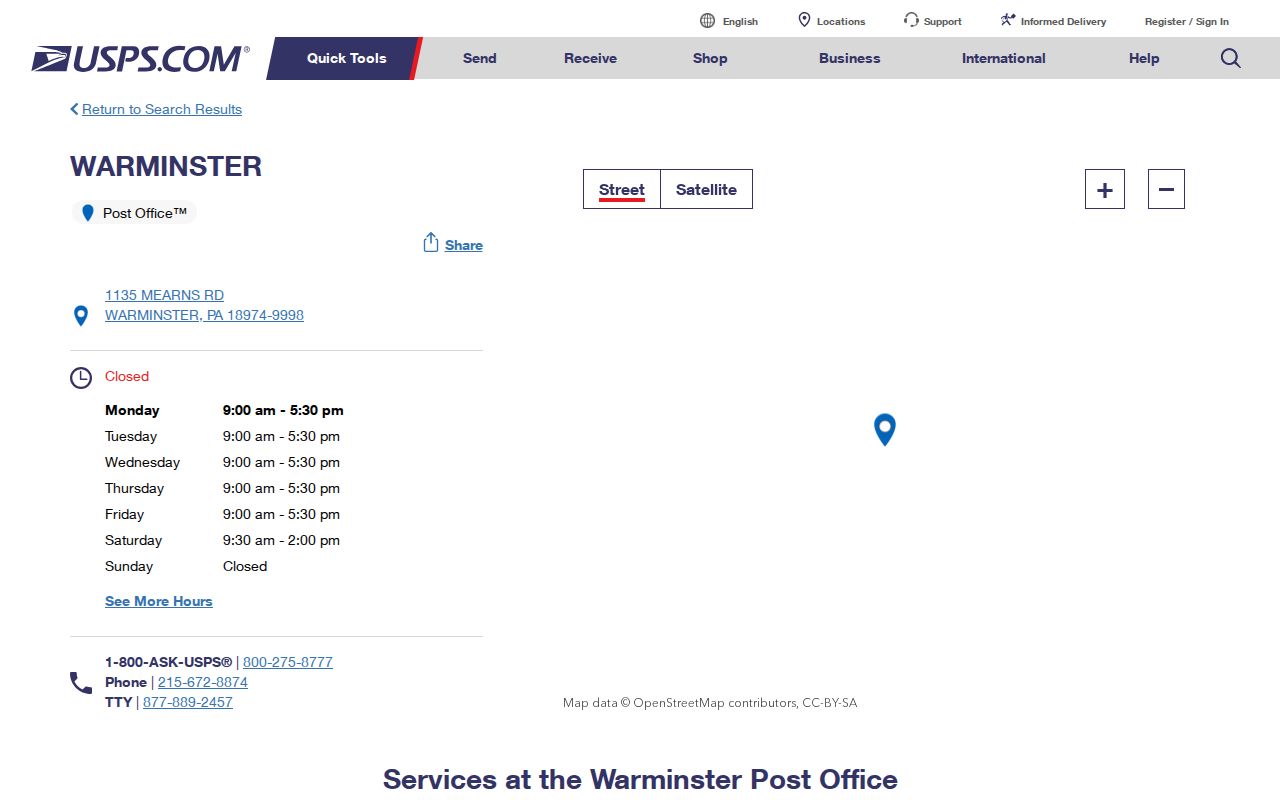
That two-source check matters at an edge, where postal city names, school districts, legislative districts, and municipal lines can all differ. The postal result is still valuable, but it answers a narrower question than a parcel record.
Note: The USPS address result should be kept with the date checked, because postal delivery details can change independently of a recorded parcel description.
Search a Warminster Township ZIP Code in Tax Fields
Bucks County's Tax Information search has a real ZIP field, but that field sits with owner mailing information. It can help identify tax records whose mailing ZIP matches the entered text. It is not a button for every parcel physically inside one postal zone. The form separately handles the physical Location Address and the Municipality filter, so a Township search should use those fields for local geography and read the mailing ZIP as a separate fact.
| Form field | Type | How it works | ZIP-related meaning |
|---|---|---|---|
| Parcel Number | Text | An alternative to name or address; all dashes are required. | Connects the record to a property, not a postal-boundary query. |
| Location Address | Text | House number and street name only. | Physical situs search, separate from the ZIP field. |
| Municipality | Select | Optional local-jurisdiction filter. | Choose Warminster for a Township-focused query. |
| Mailing Address and City | Text | Owner tax-correspondence fields. | May differ from the property situs. |
| Zip Code | Text | Optional mailing ZIP filter. | Does not establish Township residence or a municipal boundary. |
The form also accepts a name field and a School District filter. Enter either a parcel number or name or address according to the form's instruction, and retain all dashes in a parcel number. If a recent deed is involved, remember that the Board of Assessment uploads data weekly and warns that ownership information can lag recorded deeds. A current Recorder document may therefore be the better chronology check while assessment data catches up.
Warminster Township Parcel and ZIP Bridge
A Bucks parcel number is the bridge between a mailing question and a mapped property. The Board of Assessment assigns parcel numbers, maintains tax maps, and updates mapping for deeds and subdivisions. Begin with the physical location address or an existing parcel number, confirm the municipality, then use the map to review the property footprint. The associated assessment route can distinguish the property address from owner mailing fields. A ZIP remains one useful field in that record, not the single key that controls every local search.
Bucks County Maps and Data is the County entry point for mapping resources. The documented parcel-and-floodplain viewer can search by parcel number, zoning, or address and has a Warminster Township bookmark. Its parcel layer exposes fields such as parcel number, address, municipality, deed area, owner fields, valuation fields, land-use code, and modification date. It does not contain mailing address or ZIP, which is exactly why it complements rather than replaces the tax record.
For a county property record, keep four terms separate: postal address, municipality, parcel number, and legal description when it appears. A legal description, lot or block reference, or subdivision reference can survive a road-label or development change better than an informal address search. No official source in the research established a local renumbering or ZIP realignment date, so such changes should not be asserted without a dated map, plan, or request response.
Finding Warminster Township Records by ZIP
ZIP-based work in Warminster Township has a narrow, defined role. The Tax Information form accepts a mailing ZIP filter. The public voter-status tool is designed for an individual's registration check, and no verified ZIP-search mode was found for it. Bucks GIS is better for the municipality and parcel part of the question, not for assumed ZIP polygons. Use the sequence below to narrow a property-record question without treating the result as a complete list of people in a delivery area.
- Use USPS address lookup or the verified post-office record to confirm the postal label for the specific delivery address.
- Search Bucks Tax Information by Location Address and Municipality, or use a known parcel number with its required dashes.
- Read the mailing address, city, and ZIP fields as tax-correspondence details, distinct from the physical situs.
- Open the Bucks mapping route to confirm the parcel and municipality when the Township line matters.
- For a recent ownership change, use the Recorder's recorded-document route to check chronology against the weekly assessment upload.
After a postal area has been narrowed to a physical address, the Warminster Township streets directory provides the address-led record sequence. It handles parcels and recorded documents by street rather than repeating the ZIP code directory's postal-boundary check.
Warminster Township ZIP Code Boundary Limits
Postal routing boundaries and Warminster Township limits are different maps. The research confirms only 18974 as the central official USPS Warminster location and does not identify an authoritative public postal polygon that can be overlaid on the Township line. An address may carry a useful Warminster mailing label while the local research question still requires parcel, situs, legal-description, and municipality confirmation. That is why the County's address and mapping tools should be used alongside USPS, not replaced by them.
The County tax form makes the same distinction in its labels: Location Address is the physical property field, while Mailing Address, City, and Zip Code are owner-information fields. A tax mailing address may be an agent, trust, office, forwarding address, or owner address. It does not establish the full household at the property. Use the correct field for the question, then cite the source and date checked.
Warminster Township ZIP Code Terms
These terms explain why a postal search result needs a second local check. They describe postal concepts in plain language, not extra verified Warminster Township codes. The research did not establish a local post-office-box-only code or a unique institution code, so neither should be inferred from the definitions.
- ZIP code
- A USPS routing label for mail delivery. It is not a municipal boundary or parcel identifier.
- ZIP+4
- Additional digits that help USPS sort mail more precisely within a base ZIP; they do not replace the full delivery address.
- PO box ZIP
- A code associated with post-office-box service. No such Warminster Township code was verified in the research.
- Unique ZIP
- A code used for one organization or delivery arrangement. No local unique code was verified here.
- Carrier route
- A mail-delivery grouping used by USPS. It is not proof of a Township boundary or household roster.
For official public-record requests involving a property, state the street address, municipality, parcel number if known, record type, and date range. The Township's Right-to-Know route and County records routing are more likely to locate a defined property file than a broad request based only on a postal code.
Warminster Township ZIP and Old Place Labels
Warminster's history adds a useful geographic caution. The Township developed from early Bucks County settlement and a long farming history, so older records may use rural-route, village, Johnsville, Hartsville, farm, road, or legal-description language instead of a modern standardized address. A postal reference cannot translate those labels on its own. A dated map, a deed description, and a parcel or municipality check are the safer bridge between a historic place name and a current mailing address.
The Township's 275-year history supplies place and development context, while the Craven Hall collection includes maps, deeds, and tax ledgers that can help reconcile old descriptions. Neither source proves a modern delivery assignment without a separate USPS check. That measured comparison keeps a historical place lead from becoming a mistaken geographic conclusion.
Note: When an old road or village name appears, record its source date first and test any modern address match against a deed or map before using it.