
Trace Warminster Township Streets
A Warminster Township street directory is most useful as a record trail, not as a roster. Begin with the Bucks County Tax Information search. It accepts a location address as house number plus street name and can be narrowed by municipality. Select Warminster when the same street name appears elsewhere in Bucks County. The returned parcel is the bridge to assessment information, map context, and the Recorder trail. Write down the situs address, the physical taxable-property address, separately from the tax mailing address.
Then check the parcel in the assessment system and use county mapping to see its location. For a recent transfer, compare the assessment owner field with the recorded deed because the Board of Assessment uploads data weekly and warns that ownership display can lag recording. Pennsylvania's public voter-status tool is for an individual registration check, not a public street-browse tool. If an older household question remains, ask the local library or historical repository to confirm a particular directory volume rather than assuming a reverse directory exists.
- Enter the house number and street in the county tax form, then select Warminster as the municipality filter.
- Record the situs, parcel number, ownership field, and mailing field as distinct facts.
- Open the same parcel through the assessment and map routes to check municipality and parcel context.
- Use the owner and approximate acquisition period to locate the recorded deed through the Recorder.
- For historical occupants, pair a confirmed directory edition or census image with the deed trail and cite each date.
Note: A street result is strongest when the parcel, municipality, and document date all point to the same property.
Use Warminster Township Street Fields
The tax form is designed for property research. Parcel Number is an alternative to name or address and must keep its dashes. Location Address takes the house number and street. Municipality, school district, owner name, mailing address, city, and ZIP are separate filters. The ZIP field concerns the tax correspondence address, so it is not a Township-boundary test. The owner name examples use last-name-first formats, which can help when an address search is incomplete.
| Tax-search field | How it works | Street-directory meaning |
|---|---|---|
| Location Address | House number and street name | Starts an address-led parcel search. |
| Municipality | Optional dropdown | Choose Warminster to narrow a countywide street name. |
| Parcel Number | Alternative field with dashes retained | Connects tax, map, assessment, and deed work. |
| Name | Alternative owner search, last name first | Finds a titled-owner tax record, not every occupant. |
| Mailing Address, City, ZIP | Optional correspondence filters | Describes tax mail, not proof of presence at the parcel. |
The screenshot of the Bucks County tax property search shows the separate parcel, address, name, municipality, mailing-city, and ZIP inputs used for this Warminster Township street directory workflow.
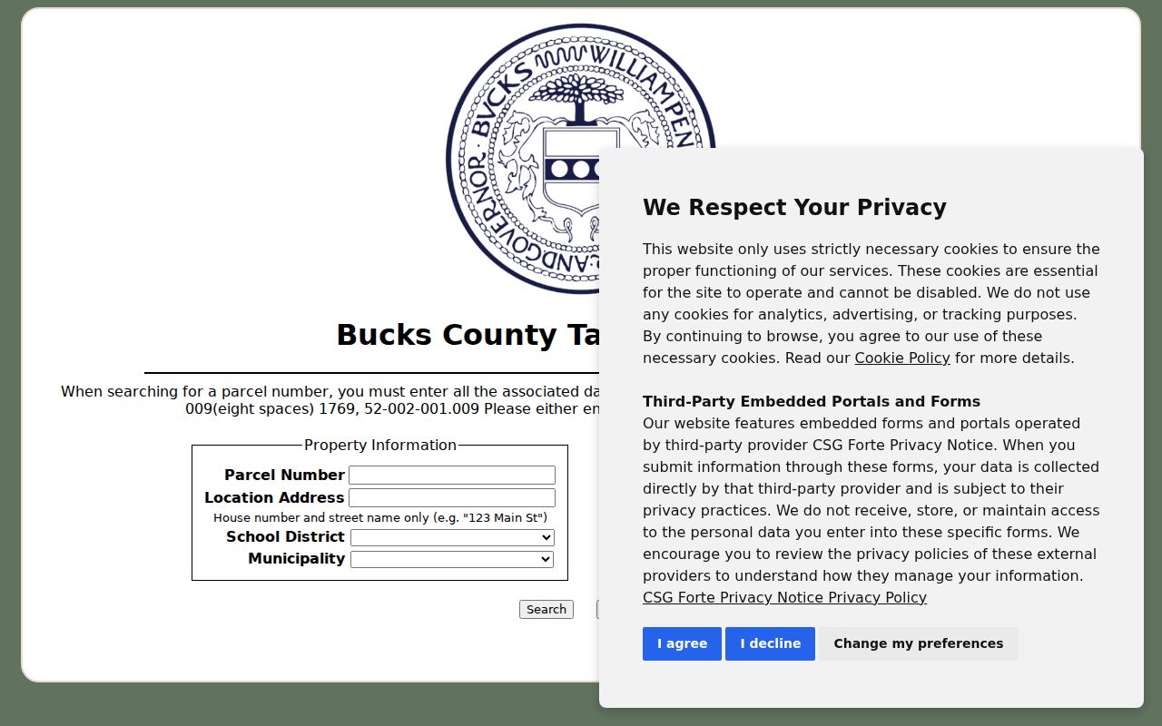
Those distinct fields are why a mailing ZIP or owner name should never replace the situs and municipality when identifying a property on a Warminster Township street.
Map a Warminster Township Street
The Bucks County Maps & Data route supplies the spatial part of a street directory search. Find the subject street, identify the parcel when the live viewer makes that available, and note the parcel number and municipality. The Board of Assessment says its tax-mapping staff maintains parcel mapping, processes subdivision and deed-map changes, and assigns parcel numbers. Mapping shows a parcel footprint and its position. It does not show household relationships or turn adjacent lots into a social list.
The Board's public assessment entry is useful after the map step because it can place the address and owner-related property fields beside the parcel reference. The county's documented assessment record includes the parcel identifier, situs address, owner name, mailing address, municipality, school district, and assessment/map relationship. These are record labels, not interchangeable claims about who is physically present.
The Bucks Board of Assessment Public Access System entry screen is the next official route after locating a Warminster Township parcel.
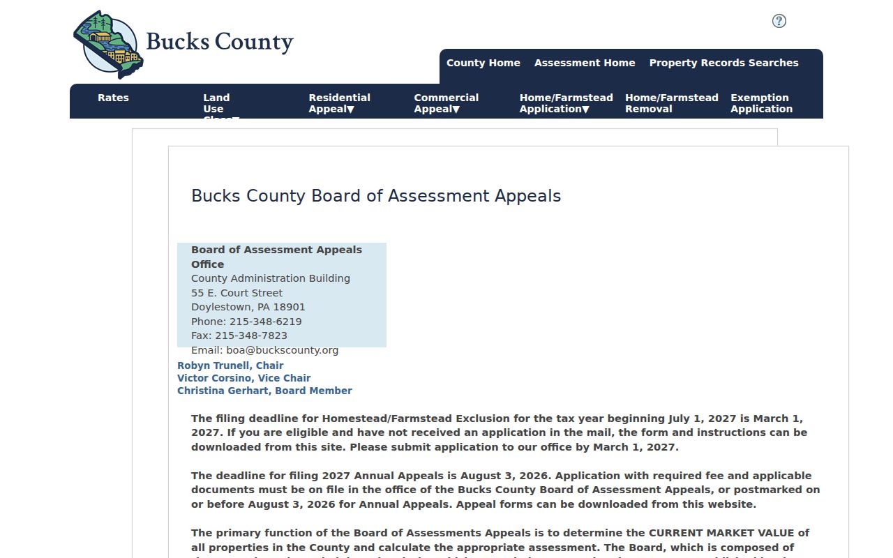
Use the assessment view to cross-check the mapped parcel, then retain the parcel number for any Recorder or municipal request.
- Parcel
- A county-assigned property identifier that links a mapped tract to assessment and recorded-land research.
- Situs address
- The physical address of the taxable property. It differs from a correspondence address used for tax mail.
- Legal description
- The lot, block, subdivision, or other recorded land description that can remain useful when an address changes.
- Criss-cross directory
- An address-ordered directory that may list one printed occupant for a particular edition, if a verified volume exists.
Warminster Township Street Records
Each official source answers a narrower question. The tax and assessment systems identify parcel and tax-context information. GIS supplies location and boundaries. The Recorder supplies recorded document parties and descriptions. Warminster Licenses & Inspections can hold event records tied to an address. The Pennsylvania voter-status route supports the individual registrant, not a public street directory. Keep the results in separate columns so that a title record is not mistaken for a household list.
| Address record | Custodian | What it contributes | Access and limit |
|---|---|---|---|
| Tax information | Bucks County | Parcel, location, owner, tax mailing fields | Public form; no complete occupant list. |
| Assessment property record | Board of Assessment | Parcel and assessment context | Public Access System; update may follow a deed. |
| Parcel map | Bucks Maps & Data | Parcel position, boundary, municipality | Map route; proximity is not a personal connection. |
| Recorded land | Recorder of Deeds | Parties, instrument history, legal description | LANDEX or public research area; not a household directory. |
| Permit or code file | Warminster L&I | Work, inspection, or enforcement chronology | Online application and defined-record request route; access can be limited. |
When one source does not answer the question, use the next custodian rather than forcing an inference. A defined request to Warminster Licenses & Inspections should name the address, record class, and period. The Township's online materials confirm applications and complaints but did not establish a public address-results database.
Read Warminster Township Street Deeds
A deed chain turns a current parcel into a dated owner history. The Bucks Recorder property-records page identifies county recorded-land holdings from 1684 to the present and directs online researchers to LANDEX. Bucks uses Direct Party for a grantor or seller, and Indirect Party for a grantee or buyer. Start with the owner shown in the recent property record, search that person as an Indirect Party around the acquisition period, then use the prior grantor as the next historic name.
Capture the document date and the legal-description or plan reference when it is displayed. Historic Bucks index books are grouped into periods from 1684-1919 through 1999-present, and they are not all pure alphabetical indexes. An approximate year and name variation matter. LANDEX is the paid online route, while the Recorder maintains a public research area. Deed and mortgage copies carry the county's stated page and certification charges, so check the Recorder's current schedule before ordering.
Note: A deed establishes a recorded transaction, not a complete record of all people who used the address.
Check Warminster Township Street Ownership
The Board of Assessment's weekly upload notice is a useful local caution. A fresh deed can appear in the Recorder path before the assessment owner field changes. For a Warminster Township street directory search involving a recent sale, compare both records and keep their dates. The deed is the better source for the recording chronology; the assessment record remains valuable for parcel, situs, tax-map, and property-card context.
This difference can also explain a seeming mismatch between the title field and a tax mailing field. A tax mailing contact may be an owner, a trust, an office, an agent, or another correspondence destination. It should be followed only as a record lead. The property location and current physical presence are separate questions.
Request Warminster Township Street Permits
Warminster Licenses & Inspections handles building, zoning, use and occupancy, permits, and code enforcement. That makes its files useful for a construction or inspection timeline along a street. The online route accepts applications and complaints, but the research did not verify a public search screen that returns records by address. A targeted request is the documented fallback: identify the exact address, the permit, inspection, or code category sought, and a defined date range.
The Township's Right-to-Know Law information provides the municipal request route. Its form allows a requester to choose copies or inspection, and asks for as much detail as possible about records requested. A permit applicant or inspection date can mark an event at a parcel, but it does not by itself show ownership or a full household history.
Know Warminster Township Street Limits
A Warminster Township street directory cannot show every person connected with an address. Parcel ownership, a tax mailing field, and a deed party answer different questions. The individual Pennsylvania voter-status tool is not a street roster. Utility customer information and motor-vehicle personal information are not open address directories, and the federal Driver's Privacy Protection Act limits disclosure and use of DMV personal information. Protected addresses also require care.
Separate Warminster Township Street Geography
Warminster's verified central postal identity is 18974, but a ZIP is a USPS routing label rather than a Township boundary. The USPS Warminster Post Office record confirms the postal location. For street research, use the tax form's location-address and municipality fields to establish the parcel's governmental context. Its ZIP field filters an owner's mailing information and cannot prove that an address is inside the Township.
At an edge or where an older mailing label appears, confirm the delivery address with USPS and confirm the parcel municipality with Bucks mapping or assessment. The legal description, parcel identifier, and situs are often more stable than a casual postal label.
Handle Warminster Township Street Gaps
Older Warminster research needs a dated source, not a guessed modern address. The Township began as a farming community, and older records can use farms, villages, roads, tax ledgers, or legal descriptions rather than current numbering. No official source in this research verified a Warminster street-renumbering project, a local Sanborn coverage run, or a local reverse-directory run. Those absences are instructions to verify, not invitations to fill a gap.
The Township's digital history and the Craven Hall collection can help identify historic places, maps, deeds, tax ledgers, and photographs. They are leads that need confirmation through a document or collection item. The finding aid describes a collection rather than a searchable street index, so ask the repository for the relevant item, date, and access terms. A map can clarify a place name; a deed or tax ledger is still needed to connect that clue to a property.
For a household question from a particular era, ask the Warminster Township Free Library or a historical repository to identify a confirmed directory volume. Capture its title page and key before relying on an entry. The historical collections are addressed in the Warminster Township city directory collections before a street conclusion is made. This keeps a useful local clue from being mistaken for a current street result.